A bit longer than our usual posts, this interesting piece was excerpted from a talk given by Mrs Simeon B. Baker to the Historical Society of Old Yarmouth on March 29, 1954
The history of West Yarmouth begins with the settling here of Yelverton Crow whose surname changed to Crowell. In 1639 a bargain was supposed to have been struck between an Indian sachem and Yelverton Crow. The story is the latter was to have as much land as he could walk over in an hour for the consideration of an ox chain, a copper kettle, a pewter porringer, an English coin and a few other items. While there was still a spoonful of sand to run its course in the hourglass they took along with them Yelverton either grew tired of walking or decided that he had driven enough of a bargain. He finished the business by cutting a bold C and a crossbar in a great pine, thus marking the final boundary. The land extended from Eel Pond near Parker's River to the South Sea (Nantucket Sound) and to the mill stream beyond Englewood and Colonial Acres, including Great Island and its connecting link of land.
The 1858 map of West Yarmouth, including Great Island.
Here was an abundance of land suitable for tilling and extensive salt marshes which offered plenty of fodder for the sheep and cattle. On the 1858 map there were two houses on Great Island, one belonging to a Crowell and the other to a Hallett. On “The Lane” (South Sea Avenue) there were 14 homes, 10 of which were occupied by Crowells, the others by a Lewis, a Hallett, a Taylor and a Baker.
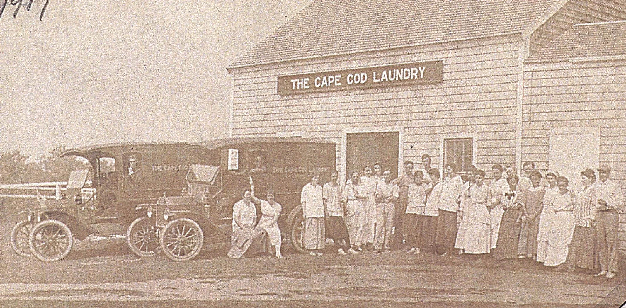
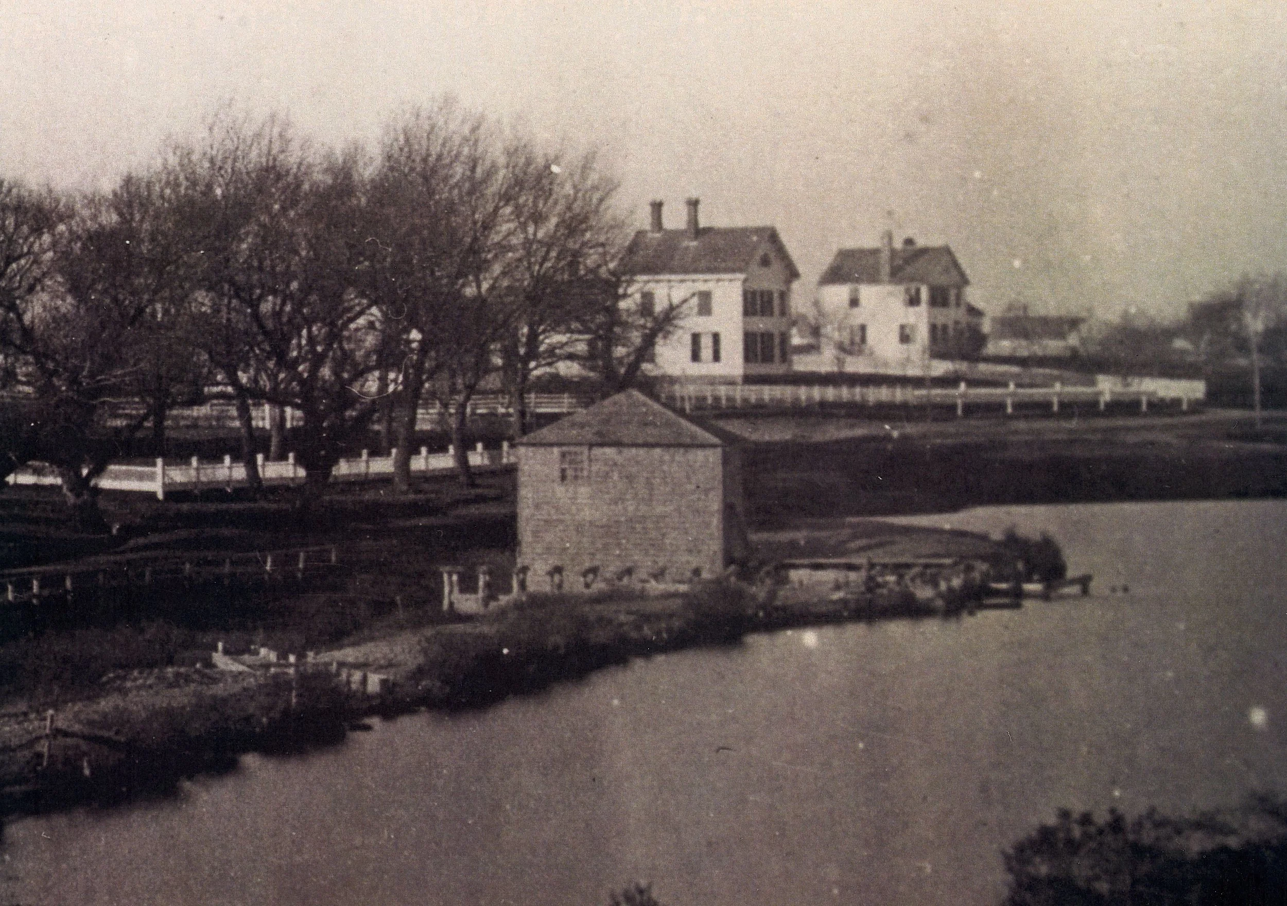
Near Great Island on the mainland were salt works and an establishment where lamp black was made. Salt was made in this vicinity as early as 1839. The lamp black was manufactured by a man named John Bangs who lived in the house which later belonged to radio station WOCB.
Radio Station WOCB circa 1950.
There was also a district schoolhouse, the second one having been built on that site which was almost directly opposite the residence of Captain Elkanah Crowell (see map), the sixth generation from Yelverton. From earliest times the people maintained their schools and it would have been hard to meet in Yarmouth or Dennis any wholly illiterate person.
Many of the old dwellings on South Sea Avenue could still be seen in the 1950s. Some have been torn down or moved. With the facilities of those early days it seems strange that so many dwellings were moved and some quite a distance, but the structures themselves were not too large to handle, put together with pegs and with no cellars in most instances to hamper operation. The men were an ingenious lot when it came to getting a house shifted to a new location. The structures were sometimes flaked or moved by capstan and horse or across water on scows.
The house at 155 South Sea Ave was built by Captain Zadok Crowell in 1832 or 1833. This residence is the third house which has stood upon that land since Yelverton's day. Zadok sailed his own schooner to Maine; he had the lumber cut and numbered and brought it back to Cape Cod. Sixty neighbors helped to raise the house and the building of it was accomplished in one day. Grandmother Crowell rewarded the workers with clam chowder and mince pie. Grandfather Crowell, not to be out done, produced a barrel of rum.
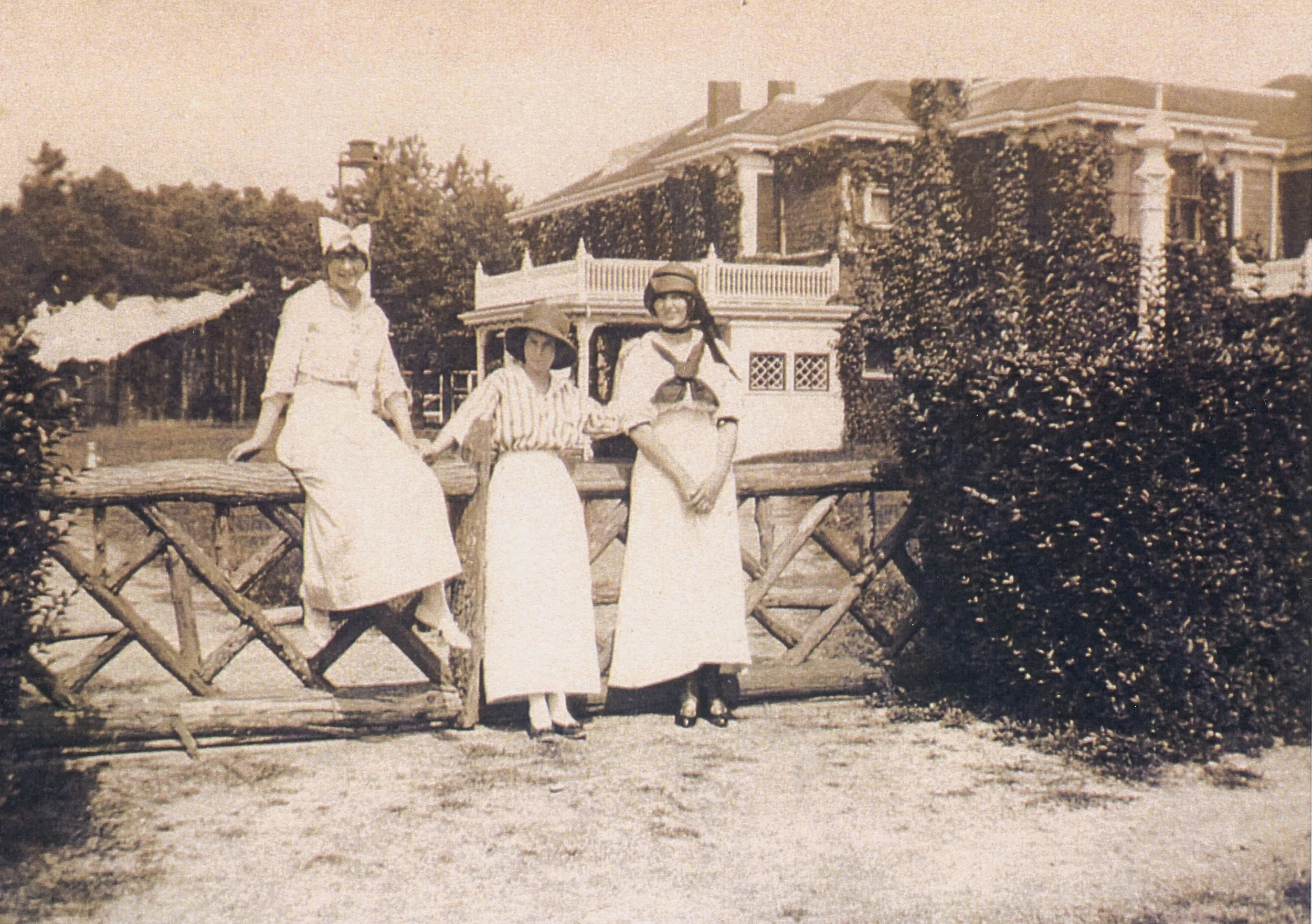
When Mr. and Mrs. Joshua F. Crowell settled there they had much of their land plowed up for gardens. The soil was blackly fertile and plowing and cultivation unearthed a great number of arrowheads. A rounded stone about as big as a man's fist girdled by a groove was also found. Around the groove formerly passed a thong so that the missile might gain extra force by being twirled above the head.
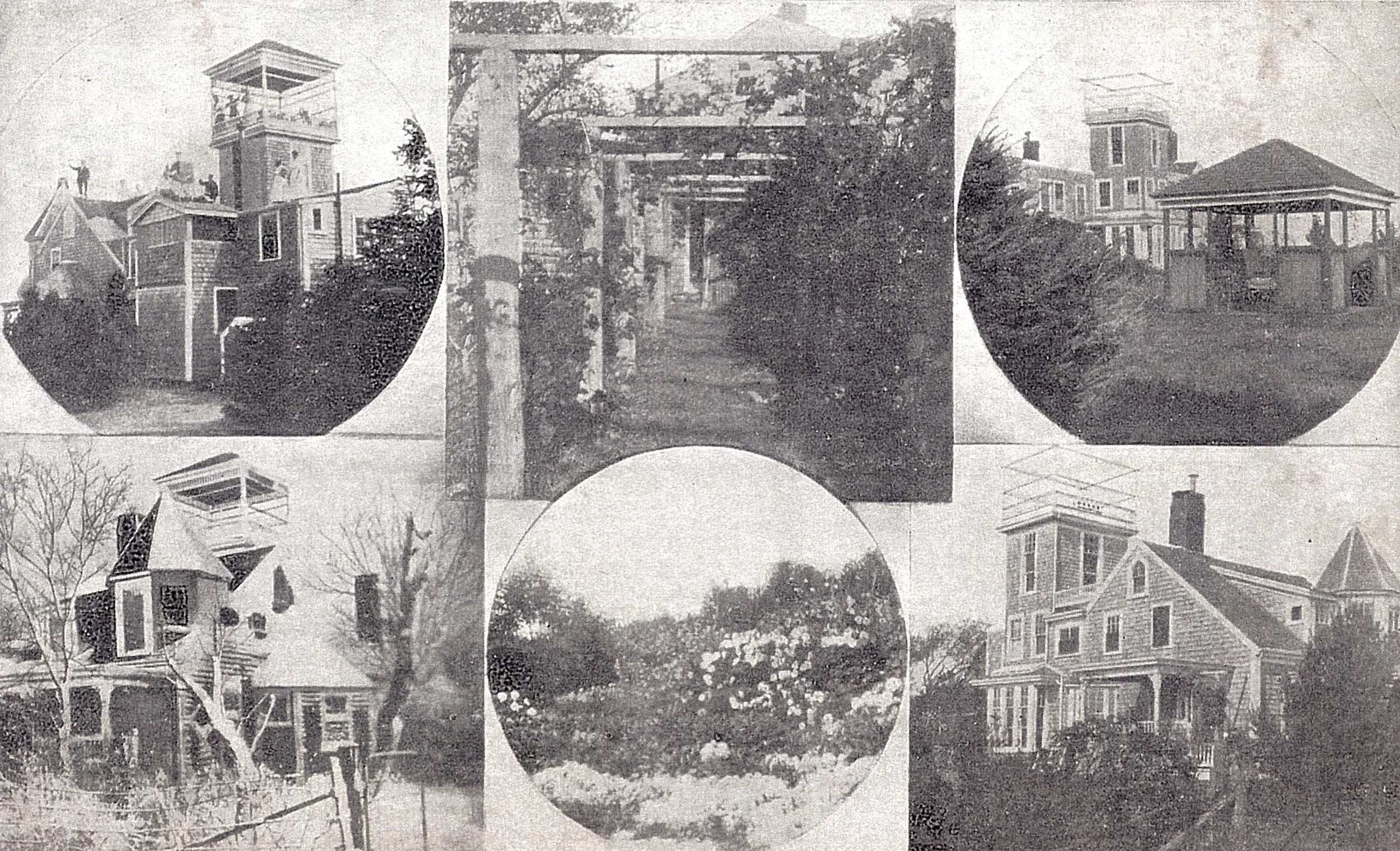
Views of “Creltholme”, the house and gardens of Mr. & Mrs. Joshua F. Crowell. The tower, gazebo, and turret were destroyed in a 1928 hurricane. The house is still there, but today is a simple Cape style home.
Leaving South Sea Avenue and crossing the county road (Route 28) was the site of the first meetinghouse of the West Precinct built in 1794. About the year 1832 this structure was replaced by a more modern one with horse sheds in the rear to the east. This newer building was moved for $500 by Nelson Eldridge of South Yarmouth during the winter of 1907 to 1908 to its present location next to the schoolhouse (the West Yarmouth Library now stands where the schoolhouse was). A path behind the homes on the south side of the county road was made in its moving which took many weeks as the motive power was horse and capstan.
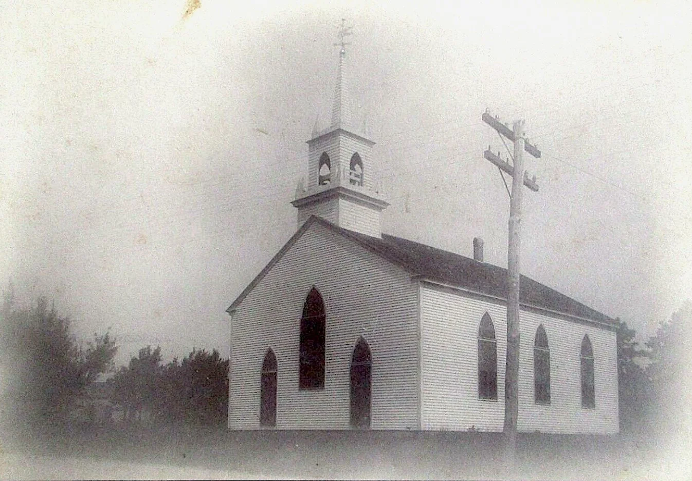
The West Yarmouth Congregational Church, prior to its move in 1908. It stood about where the current West Yarmouth Post Office is today.
Almost opposite South Sea Avenue is a road (West Yarmouth Road) which was used by those on the south side to go to the meeting house in Yarmouth Port before the church was built here. One of the residents told me how her ancestors used to go to church in an ox cart for the smaller children, the older ones walking, often removing their shoes and stockings to preserve them. The life of the town both public and private gathered about the life of the church.
Going west along the county road we come to Woodside Cemetery. In the days when the cemetery was laid out it was customary to have the burial ground in the vicinity of the meeting house but at that time the people of South Sea (West Yarmouth) attended services on the north side of town, hence the desirability of a burial place near their home village. The earliest settlers were of limited means so the first burials were not marked by headstones. Yelverton Crow died in 1683; undoubtedly he is buried here in an unmarked grave with his many descendants.
Going west we come to what was the Yarmouth Arms (this building, now replaced by a CVS, burned down in 1971). The old part of the building was the home of Captain John Hallett of Great Island. Freeman H. Crowell, who married Captain Hallett's daughter, had the house moved to the site. The premises passed to the ownership of F. A. Abel, who greatly enlarged the building and extended and beautified the grounds. In back of this house the old district school house stood for a time in the woods. It was transformed into a hall and was subsequently destroyed by fire.
The home of F. A. Abel, about 1910.
Across from the former Abel estate is the park where once stood the Farris windmill, believed to have been the oldest on Cape Cod. (For more on the Farris Mill, see this blog post).
Continuing west we come to the schoolhouse erected in 1854 (now behind the West Yarmouth Library). In the 1870s, at least half the pupils were Crowells. On the third floor was a Sloyd room where older girls and boys learned to use the simple tools of carpentry. This building had a belfry tower and the children took turns ringing the bell for school and on the 4th of July.
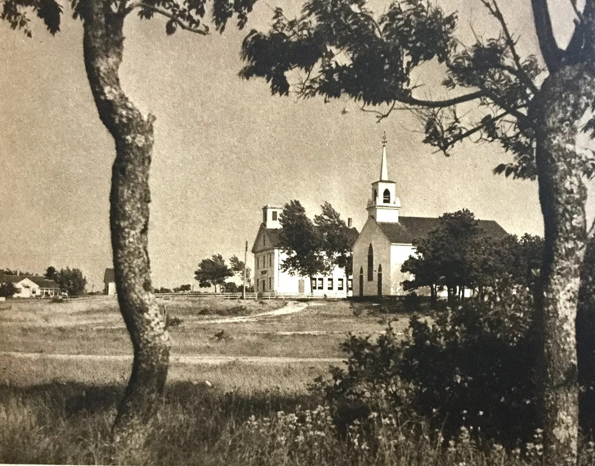
The former schoolhouse, next to the Congregational Church, after 1910.
Behind and to the east used to stand the old hearse house where the village hearse was kept. Later it housed the fire wagon with its ladders and buckets.
Opposite the [Chase] laundry is the 1750 House (formerly at 281 Route 28, now gone). This house with its curb roof is an old timer. It was built in Marstons Mills about the year 1750 and was moved to West Yarmouth about 1768. It was bought by Deacon Anthony Chase in the late 18th century. His son the Reverend Enoch E. Chase was born there, and died in 1887 in the same room in which he was born. Alexander B. Chase, son of Enoch, had a boarding house here called The Ocean View House.
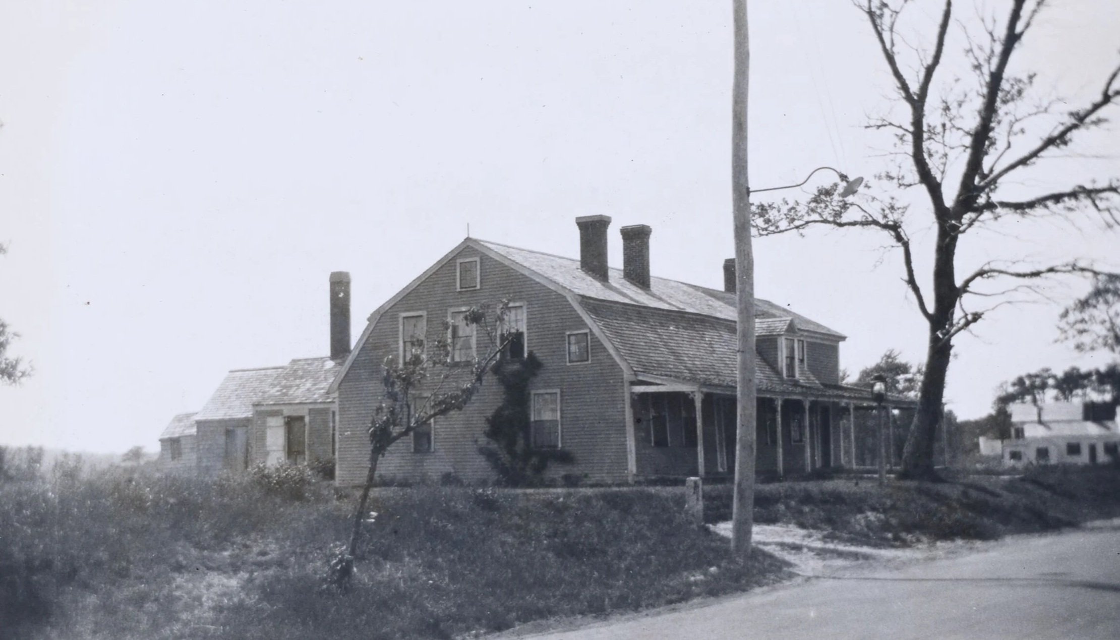
The 1750 House, later the Ocean View.
Across the street from the 1750 house was a stable. In the rear of this stable was said to be an old Indian burial place which the town had reserved in the early days, and which was located on a peninsula of upland, extending into the low ground or swamp. At a town meeting it was proposed to place stone bounds upon each one of the town’s reservations, this burial place being one. When this land was sold and the swamp made into the present cranberry bog, this peninsula was used in the bog’s construction. Many indigenous artifacts were found and lost.
We now come to Mill Hill. On the south side of the highway stood the home of Eleazer Baker, and this hill was known as Eleazer's Hill. A dancing pavilion called Mill Hill Pavilion was erected and attached to the old house. Several years later fire destroyed the structure and the Rainbow Ballroom was built across the street. On the south side of the highway stood the residence of Captain Alexander Baxter, quite an extensive owner in shipping. Some years later this building was moved farther west to the corner next to a road leading to Lewis Bay, and a large double house was erected on the old site. Here the captain and his good wife resided for many years. In 1876 this fine residence was destroyed by fire.
The Baxter Mill.
The old grist mill directly opposite the Captain Baxter residence was known as Baxter's mill, having been built by the Baxter Brothers in 1789. The interior still has the heavy beams and the well-worn stairs leading to the upper story where the corn was ground into metal between two great Stones turned by a water wheel. Mrs. Reginald Love told me that she remembers going there with her father to get some corn ground. The aroma of the new ground corn, the terrible noise made by the stones grinding it, and the sound of the turning water wheel, with the roar of the water tumbling over it, were lasting impressions made by that visit.
Written and researched by Mrs. Simeon B. (Frances Johnson) Baker, with edits by Nancy Mumford